Location: Hjelmeland (Bjorheimsheia)
Time: 4 hours
Distance: 11 km
Elevation: 787 mas
This hike starts from the parkinglot on top of Leite (GPS position N59 03.770 E6 03.921).
The trail is well marked with both signs and redmarking. The area has several trails and on a sunny day there will probably be quite a few people at the beginning of your hike.


The hike is a hard one as there are long sections of steep climbs and the terrain goes up and down, but in return you always have an amazing view either in the front or at the back, or even both.
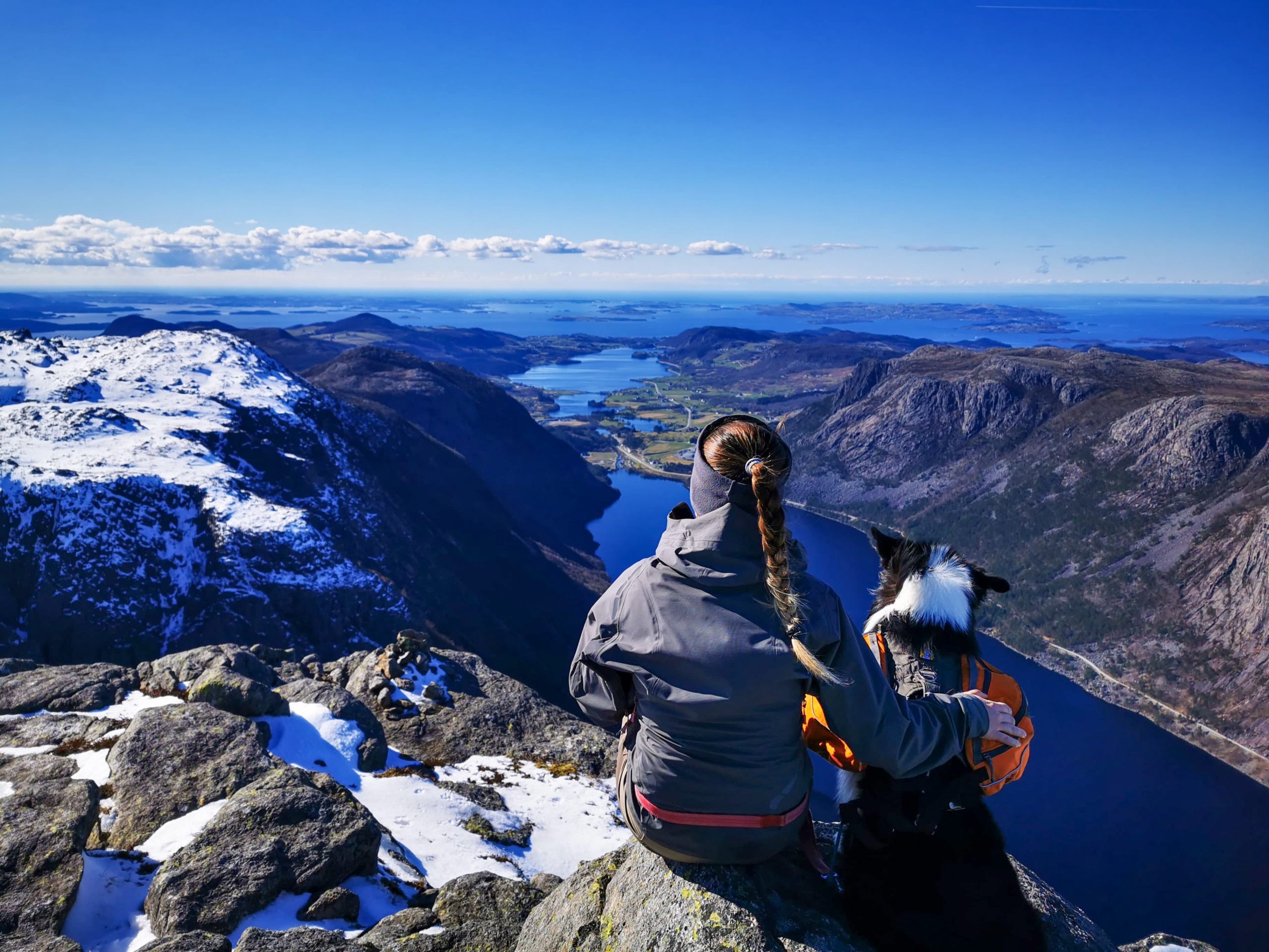
When we did the hike in march there were quite a lot of snow, which naturally makes the hike more demanding.


The view from the top is amazing and you can practically see all of Ryfylket.